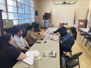
The Sulphur Springs Water Alliance is committed to advancing regional water awareness, conservation, and community engagement across southeastern Arizona through education, outreach, and collaborative partnerships. To support these efforts, a graphic design class will develop a suite of marketing and outreach materials that strengthen the Alliance’s public presence and communicate key messages related to water […]
Read More… from Sulphur Springs Water Alliance Design
Communities across Arizona are increasingly focused on long-term water sustainability and public awareness, creating opportunities to engage younger generations in conservation efforts through education, outreach, and community-based initiatives. This project will explore youth engagement strategies centered around water conservation, with an emphasis on empowering students and young residents to become active participants in promoting sustainable […]
Read More… from Youth Water Conservation Engagement Strategies
The City of Kingman, located in northwestern Arizona on the Colorado Plateau, is shaped by its historic resources, transportation legacy along Historic Route 66, and proximity to regional recreational assets, and is seeking planning strategies that preserve its historic significance while strengthening downtown economic activity. As the City examines connectivity, visibility, and traveler engagement within […]
Read More… from Developing a Vision for the I-11/I-40 Gateway
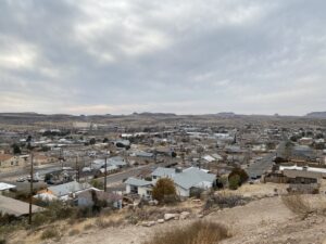
The Town of Miami is a historically significant community with a rich architectural and cultural legacy that reflects its mining heritage. As the community looks toward revitalization and long-term economic resilience, the Town is seeking to strengthen its historic preservation framework to better protect its assets, support local property owners, and enhance its appeal to […]
Read More… from Miami Historic Preservation Framework
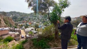
The Tijuana River watershed originates in Mexico and flows into the Tijuana River Estuary, a protected coastal wetland in California where freshwater and saltwater converge, supporting unique biodiversity. This ecosystem is threatened by vegetation loss, pollution, sedimentation, and high levels of fecal bacteria at the river mouth, affecting both biodiversity and resilience. Around 250 families […]
Read More… from Restauración de servicios ecosistémicos en la Subcuenca Los Laureles, Tijuana, México
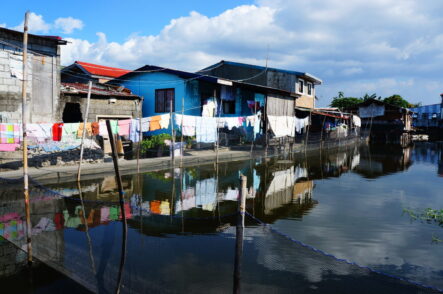
LIRLAP takes a dynamic perspective and assesses the impacts of future urban growth and densification scenarios in Metro Manila on, first, the future growth of informal settlements by means of urban growth models considering the urban morphology and socio-economic factor and, second, on the future availability of land suitable for receiving resettlement (WP 1). Moreover, […]
Read More… from LIRLAP: Linking disaster risk governance and land-use planning: the case of informal settlements in hazard prone areas in the Philippines, Thailand and Vietnam
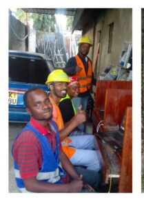
The Vision: The Badilisha Digital Resource Centers (DRC) project is a school-community affiliate initiative that transforms educational institutions into hubs for regional digital resilience. By leveraging professional-grade telecommunications infrastructure, we create a “Digital Commons” where university innovation directly fuels community economic growth. Partners & University Assets: Building on my foundation as an alumnus of Uganda […]
Read More… from Badilisha Digital Resource Centers: School-Community Affiliate Hubs for Resilience