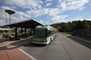
To improve the connection between active and public transportation in Lane County, the Bicycle Transportation class partnered with Lane Transit District (LTD) and Cascadia Mobility to produce comprehensive street redesigns, GIS mapping and implementation recommendations, and community outreach findings. Through the lens of street design, geographic mapping, policymaking, and community engagement, students provided a basis for LTD to transform the transportation system in Eugene-Springfield and the broader Lane County area by connecting multimodal transportation options.
Students assessed current infrastructure gaps, community beliefs and needs, and the politics of redesigning streets to accommodate multimodal transportation in the region. By impacting the physical, cultural, and systemic environments, students believe LTD could further connect their service to bike infrastructure. For example, mapping studies identified gaps in bikeshare service while community engagement recorded community members’ feelings and needs surrounding bikeshare and infrastructure. Students also used policy studies alongside street redesigns to identify areas with the greatest street improvement needs, generating proposals to encourage future infrastructure improvements. In addition, one group looked at the existing transit system through an equity and access lens and advocated for prioritizing marginalized neighborhoods in transportation planning and addressing network barriers for people with disabilities.