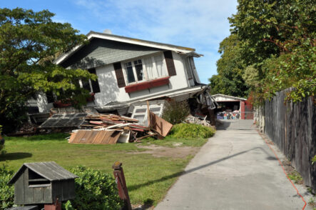
This report presents a comprehensive assessment of seismic vulnerability in National City, completed by students from San Diego State University’s Geography 584 (GIS Applications) course in collaboration with the Sage Project and the City of National City. Using Geographic Information Systems (GIS), the project combined a parcel-level inventory of residential buildings with geophysical and social […]
Read More… from Using GIS to Assess Seismic Vulnerability in National City
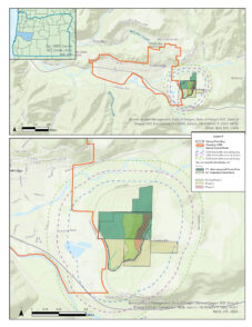
StoneBroke LLC proposed the development of Old Hazeldell Quarry, a gravel quarry located on TV Butte just outside of Oakridge, Oregon. The City of Oakridge partnered with students from the University of Oregon to preliminarily evaluate and map the potential environmental impacts of the proposed quarry using publicly available ArcGIS data sets. Specific concerns regarding […]
Read More… from TV Butte Quarry: Environmental Impact Assessment
State College Borough is home to a significant transient population consisting of many students who live off campus. This has created a strong demand for rental housing that has resulted in ever increasing rents. This in turn have displaced low-income workers in the Borough. The Borough of State College is interested in data relating to the […]
Read More… from Housing Burden and Health in State College Borough
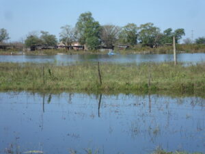
The Mapuche Community of Campo La Cruz was settled on the outskirts of Junín, Buenos Aires, Argentina, following a process of colonization and conquest during the 19th century. Located on the temperate plains of the humid pampas, its ecosystem consists of grasslands and prairies, although the expansion of agriculture and the city replaced much of […]
Read More… from Sustainable management of natural environments of a Mapuche community in the city of Junín, Buenos Aires: environmental impacts and risks in the face of climate change
A team of students in Advanced GIS conducted a two part project to support GIS development needs and application for the City of Oakridge. First, students conducted a comparative analysis of four leading open-source Geographic Information Systems (GIS) products. Given that Oakridge uses open-source GIS software for their planning work, staff sought clarification on what […]
Read More… from Open-Source Oakridge: Exploring Open-Source Software and Creating a Buildable Lands Survey for the City of Oakridge
The National City Paradise Creek expansion project is intended to expand Paradise Creek wetland protection and meet community needs by designing an alternative land use for the welding shop on West 18th Street in National City, CA. The goals of this project include minimizing stormwater runoff, reducing stream degradation, preserving the wetlands and open space, […]
Read More… from Paradise Creek Wetland Expansion in National City, CA
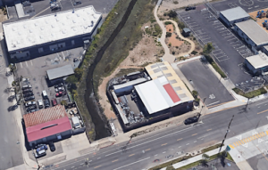
The SDSU Brownfields Assessment Project at San Diego State University (SDSU) aims to support revitalization of the National City downtown area and meet community needs by designing alternative land uses for brownfields in the community, and this report focuses on solutions for one site at 1028 A Avenue in National City, CA. The goals of […]
Read More… from National City Brownfields Revitalization
The City of Salem, Oregon, has shown dedication to achieving sustainability goals and revitalizing its neighborhoods by conducting walkability and comprehensive corridors assessments. As part of the Sustainable City Year Program, students from the Geography Department at the University of Oregon participated in an Advanced Geographic Information Systems (GIS) class in collaboration with Salem to […]
Read More… from Navigating Urban Networks: A GIS Exploration of Walkability in Salem, Oregon

The Sage Project at San Diego State University (SDSU) was commissioned to develop recommendations pertaining to governance methods utilized for Balboa Park. This comprehensive report addresses what governance model, or models, are the best fit for Balboa Park taking into consideration factors such as size, location, physical features, and the region itself. As part of […]
Read More… from Balboa Park: A Governance Analysis and Recommendation
This report presents conservation and sustainability initiatives addressing land and water conservation, renewable energy, transportation, food sustainability, and sustainable development that can be implemented on the county level with the support of government, nonprofit, and commercial organizations. UniverCity Year Contact Info: UniverCityAlliance@wisc.edu […]
Read More… from Exploring county-level conservation and sustainability initiatives for Outagamie County