This report contains the collected work of graduate student groups in PPPM 629: Public Budget Administration over the course of fall term 2022. These student groups conducted research to evaluate and forecast productivity of revenue generating activities for consideration by the city of Sisters to augment their Affordable Housing Reserve Fund. The revenue sources presented […]
Read More… from Financing Affordable Housing Subsidies in Sisters, Oregon: Creative Options and Evaluation of Potential Municipal Revenue-Generating Activities

This product is designed for Explore Sisters as a client of the University of Oregon’s Nonprofit Management Consultancy capstone course in Spring of 2023 in partnership with the University of Oregon’s Sustainable Cities Year Program. A team of four graduate students consulted for ten weeks by interviewing similar destination management organizations (DMO), facilitating a board […]
Read More… from Explore Sisters: Strategic Plan
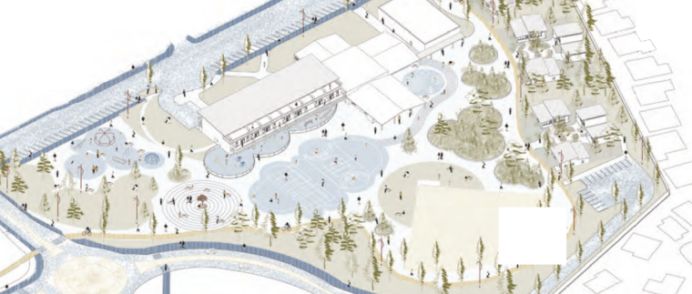
University of Oregon Architecture students proposed site designs and adaptive reuse ideas for the existing Sisters Elementary School and outdoor recreational uses and affordable housing. Student housing proposals fell into four main categories: 1) Housing on top of the school 2) Housing on the west side of the site 3) Housing in groups of clusters […]
Read More… from Reimagining Housing Options for the Sisters Elementary School Site
The city of Sisters identified the need for 1,100 housing units to accommodate its 2041 projected population growth and is exploring “efficiency measures” as an alternative to expanding its urban growth boundary. Final year Architecture students studied the situation and considered contemporary approaches to how people are choosing to live as the definition of “family” […]
Read More… from Co-Living for the Changing Family: Thriving through Sharing in Expandable Buildings
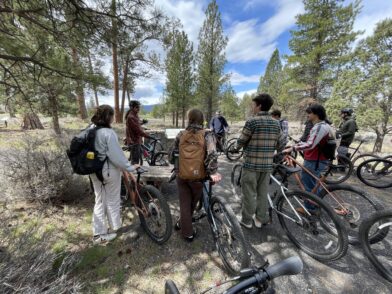
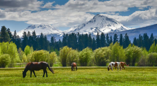
Situated in the northwest pocket of Deschutes County, Sisters includes varied outdoor recreation options, beautiful scenery, and top tier hiking and mountain biking trails. The city’s thriving downtown is bisected by East Cascade Avenue, which bustles with economic activity and serves as a throughway to Redmond, Bend, and central Oregon. The street is often congested […]
Read More… from Connecting Sisters, Sparking Bicycling Joy
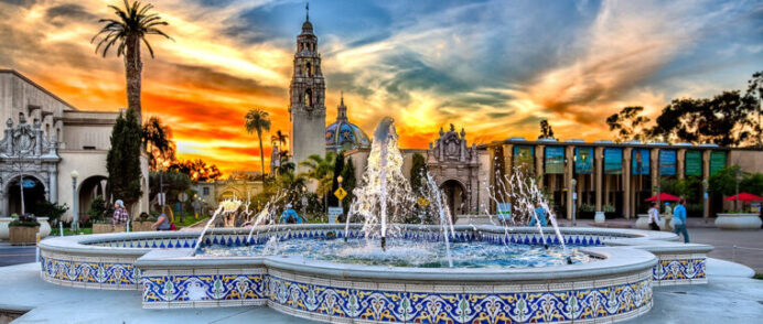
The primary goals of this project were to review and assess the implementation of the 1989 Balboa Park Master Plan and provide recommendations for future plan updates. In the first chapter of this report, we discuss previous planning efforts, including the 1989 Balboa Park Master Plan, City of San Diego General Plan, and the 2021 […]
Read More… from Balboa Park Master Plan Analysis Florida Canyon, Zoo Parking Lot, Arizona Landfill, Morley Field, and Inspiration Point

In hopes of diminishing the urban-rural divide in Oregon, the Rural Engagement & Vitality (REV) Center, a joint venture of Eastern Oregon University and Wallowa Resources, has partnered with Sarah Greenman to create a play that will tell “unheard narratives” from state residents (REV Center, 2020). The Urban-Rural Theater Project will be a verbatim play […]
Read More… from Diminishing the Divide: Connecting Urban and Rural Residents in Oregon Through Theater
In summer of 2016, the Tyler County and the City of Ivanhoe started collaboration with Texas Target Communities to assess current community conditions and explore future development strategies. The project aimed to enhance community-wide discussion through a public participatory process, resulting in the development of a strategic and comprehensive plan to help guide the future […]
Read More… from Tyler County Strategic Plan Thoroughfare Plan Report + Poster
This project verifies the dimensions of the catch basins in order to provide a variable to record and measure stormwater drainage. As requested by the city, we validated the locations of catch basins for a subset of Pacific Grove and added attributes for dimensions. […]
Read More… from Validating Catch Basin Data in Pacific Grove, California
The purpose of this project was to identify changes in in the previous tree inventory in pacific grove, like trees that have been removed or the tree density. With the data collected we will estimate the change in trees since previous inventories in a percentage […]
Read More… from Tree Inventory for Pacific Grove