
Research and design a walking map of historic Monona. Read the final student report delivered to the local gov/community partner. UniverCity Year Contact Info Gavin Luter Managing Director gavin@cows.org 608-261-1141 University Faculty Contact William Gartner Geography Senior Lecturer william.gartner@wisc.edu (608) 890-3816 Local Government / Community Contact Brad Bruun Public Works Project Manager/GIS Specialist 608-222-2525 […]
Read More… from Walking Map of Historic Monona
Identify and map unsafe transportation cooridors in Monona Read the final student report delivered to the local gov/community partner. UniverCity Year Contact Info Gavin Luter Managing Director gavin@cows.org 608-261-1141 University Faculty Contact A-Xing Zhu Geography Professor azhu@wisc.edu (608) 262-0272 Local Government / Community Contact Brad Bruun Public Works Project Manager/GIS Specialist 608-222-2525 […]
Read More… from Towards Safe, Efficient Transportation Networks

Created in 2009-2010, Town+Gown is a city-wide university-community partnership program, resident at the New York City Department of Design and Construction (DDC), that brings academics and practitioners together to create actionable knowledge in the built environment. […]
Read More… from New York City
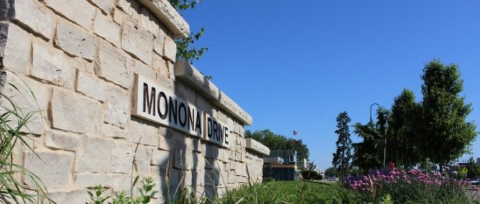
During the 2016 to 2017 academic year, the City of Monona was chosen to partner with the UniverCity Year program due to its proximity to the university and for strong support from Mayor Bob Miller. […]
Read More… from The City of Monona receives on-the-ground support to work toward a more sustainable, livable future

Resilient Cities Initiative Website: https://scnpchico.com/ The Resilient Cities Initiative (RCI) is an interdisciplinary applied research think-tank for cities and communities established by the Institute for Sustainable Development at California State University, Chico in 2016. The RCI connects real-world community sustainability projects – identified and funded by partner agencies – with faculty expertise and student innovation, […]
Read More… from California State University, Chico
EPIC The University of Nairobi in partnership with Nairobi County have joined efforts to advance sustainability and resilience using the EPIC model. Nairobi County is experiencing rapid population explosion, coupled with road expansion and increase in motorization. This current state of affairs does not reflect prioritization of non-motorized transport, particularly, walking. Therefore, residents of Nairobi […]
Read More… from University of Nairobi

Sustainable Communities Partnership Website | www.stthomas.edu/osi/scp The Sustainable Communities Partnership (SCP) collaborates with cities and government agencies to integrate community-identified sustainability projects into St. Thomas courses across disciplines engaging students in real-world, applied research and innovative problem-solving. Our partnerships seek to catalyze systems-level change towards human and ecological well-being in the Twin Cities area while preparing […]
Read More… from University of St. Thomas, Minnesota

Resilient Communities Project Website | rcp.umn.edu Communities are constantly evolving in response to their unique local challenges and opportunities. The Resilient Communities Project (RCP) is an award-winning, cross-disciplinary program at the University of Minnesota designed to build community resilience—the capacity to adapt and thrive in the face of changing social, economic, technological, and environmental conditions. […]
Read More… from University of Minnesota

The Sage Project Website | sage.sdsu.edu Facebook | @SDSUSageProject Instagram | @thesageprojectsdsu LinkedIn | The Sage ProjectNewsletter | Subscribe Here The Sage Project is a program within the Center for Regional Sustainability at San Diego State University with a simple goal: tackling sustainability goals through community-based projects. Thousands of university students are eager to use their knowledge, skills, and creativity […]
Read More… from San Diego State University

Sustaining Hoosier Communities Website |rural.indiana.edu/impact/shc Indiana University’s Sustaining Hoosier Communities (SHC), an initiative of the Center for Rural Engagement forges partnerships between local communities and leaders and Indiana University’s faculty, staff, and students to enrich the health, prosperity, and vitality of our region. Through undergraduate and graduate courses—in disciplines including public health, information systems, public policy, arts […]
Read More… from Indiana University