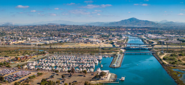
The Tijuana River watershed originates in Mexico and flows into the Tijuana River Estuary, a protected coastal wetland in California where freshwater and saltwater converge, supporting unique biodiversity. This ecosystem is threatened by vegetation loss, pollution, sedimentation, and high levels of fecal bacteria at the river mouth, affecting both biodiversity and resilience. Around 250 families […]
Read More… from Restauración de servicios ecosistémicos en la Subcuenca Los Laureles, Tijuana, México
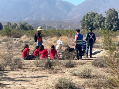
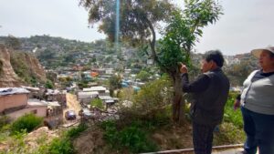
Teachers and students from FCITEC coordinated their courses around a project focused on community activity in Valle de las Palmas (municipality of Tecate, Baja California). This section of the project analyzes the legal, hydrological, resource management, and project administration aspects of construction waste management the Valle de las Palmas area, considering its impact on the […]
Read More… from Bioadaptation Project for the Ecosystems of the Valle de las Palmas River Basin – Tijuana (community intervention)
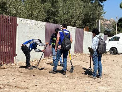
Teachers and students from FCITEC coordinated their courses around a project involving the community of Valle de las Palmas (municipality of Tecate, Baja California). The project seeks to evaluate the use of materials recovered from construction waste and glass in order to promote sustainable construction practices and mitigate the community’s vulnerability to soil, aquifer, and […]
Read More… from Bioadaptation of ecosystems in the Valle de las Palmas-Tijuana river basin. Recycling of construction waste and glass
Esta propuesta responde a la necesidad de disminuir el impacto ambiental de la industria de la construcción. El proyecto pretende promover una gestión adecuada de los residuos de actividades de la industria de la construcción, mediante el diseño y aplicación de metodologías y estrategias con criterios AbE, que mitiguen la vulnerabilidad de la comunidad de […]
Read More… from Ecosystem-based adaptation of the Tijuana River basin, focusing on recycling construction waste and glass
LIRLAP takes a dynamic perspective and assesses the impacts of future urban growth and densification scenarios in Metro Manila on, first, the future growth of informal settlements by means of urban growth models considering the urban morphology and socio-economic factor and, second, on the future availability of land suitable for receiving resettlement (WP 1). Moreover, […]
Read More… from LIRLAP: Linking disaster risk governance and land-use planning: the case of informal settlements in hazard prone areas in the Philippines, Thailand and Vietnam
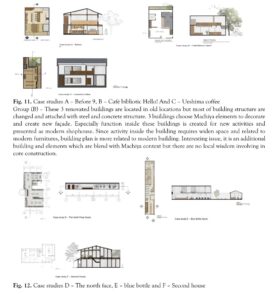
Adaptive reuse is a conceptual framework rooted in the intention to preserve existing buildings and urban spaces while adapting them to contemporary needs. It reflects a dual recognition of cultural-historical value and resource efficiency looking to keep the embedded narratives of a place while minimizing waste associated with demolition and reconstruction. This approach encompasses both […]
Read More… from A Study of Adaptive Reuse on Commercial Building Towards Heritage City on Case Study of Kyoto City, Japan
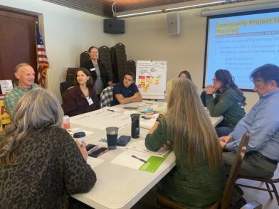
This report contains a series of policy proposals developed by San Diego State University (SDSU) students, in collaboration with National City officials and the SDSU Sage Project, to increase the use of existing earthquake preparedness resources among National City residents. The primary focus of student research was the California Earthquake Brace + Bolt program and […]
Read More… from The National City Earthquake Safety & Outreach Initiative
This project examines future water scenarios for La Paz County, examining how the growth of agriculture, tourism, and other industries could impact local water resources and community well-being. Through scenario mapping, the project will highlight both the challenges and opportunities associated with balancing economic development and sustainable water use. Students from the Master of Sustainability […]
Read More… from Future Water Scenarios for La Paz County
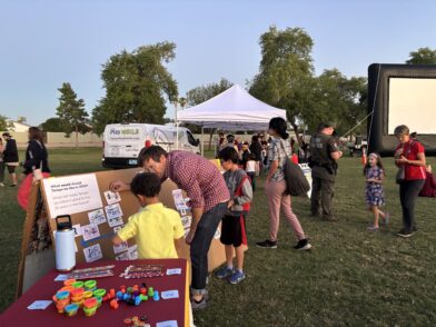
The City of Tempe is a vibrant and forward-thinking community at the heart of the Phoenix Metropolitan Area. Home to more than 190,000 residents and the Arizona State University Tempe Campus, the City is committed to promoting long-term livability, economic vitality, and equitable access to opportunities for all generations. In response to shifting demographics and […]
Read More… from Incorporating Young Perspectives into Planning Tempe’s Future
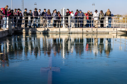
The City of Tempe is a thriving community in the center of the Phoenix Metropolitan Area. Serving a population of over 190,000 residents, as well as the Arizona State University Tempe Campus, the City aims to provide high quality services and resources for its growing number of community members and visitors. As a municipality focused […]
Read More… from Innovative Solutions to Diverting Water Treatment Solids